Access to accurate and timely information is critical to helping you understand the issues and decisions facing our City Council and Commissions and engage in the policy making process. Stay informed by reading the latest news and updates below, sign up to receive "News & Updates," the Sonoma City e-newsletter and subscribe to meeting agendas and minutes for the City Council and Commissions.
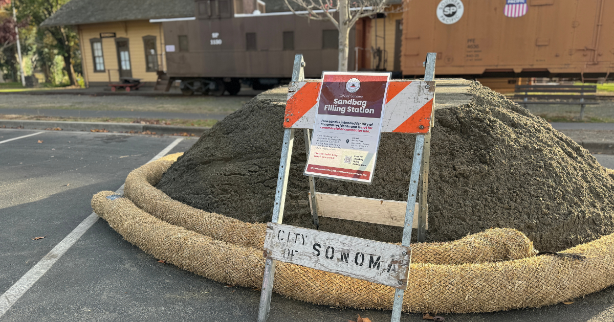
With another round of rain forecast to arrive this week, we encourage you to take time to prepare for the rainy season ahead. If your property has a history of flooding, please don’t wait for a storm to prepare sandbags. Sandbags can be prepared and kept on hand throughout the winter. Free sandbags are now...
The Sonoma Ecology Center (SEC) will conduct controlled pile burns at Montini Open Space Preserve on Friday, November 7, as part of ongoing wildfire risk-reduction and ecological restoration efforts funded by the California State Coastal Conservancy. While the park will remain open to visitors, some trails may be temporarily impacted during the operation. Please follow...
A reminder that the Sonoma Valley Public Meeting for the Sonoma County Multi-Jurisdictional Hazard Mitigation Plan (MJHMP) Update is happening tomorrow, Thursday, November 6, from 5:30 to 7:00 p.m. at Sonoma Valley Fire Station #1 (630 2nd St W, Sonoma). Hosted by the Sonoma County Department of Emergency Management, in partnership with the City of...
After a few light showers earlier this fall, the National Weather Service is reporting that a stronger system is on the way and is expected to bring widespread rain and gusty winds to the Bay Area, including the City of Sonoma, midweek. What to Expect Wind Advisory: A Wind Advisory is in effect from late...
The Sonoma County Multi-Jurisdictional Hazard Mitigation Plan (MJHMP) Draft is now available for public review and comment through November 10, 2025, on the County of Sonoma website. The MJHMP is a countywide effort involving 22 jurisdictions, including the City of Sonoma and the Sonoma Valley Fire District, both of which have annexes in the draft...
According to the latest update from the National Weather Service, the Bay Area — including the City of Sonoma — is expected to experience its first significant rain event of the season early next week. While only light rain is possible today (Friday), a stronger system is forecast to bring heavier and more widespread rainfall...
While no heat or fire weather advisories are currently in effect, the National Weather Service (NWS) is monitoring conditions that could impact the Bay Area and Sonoma Valley later this week. Heat Risk: Temperatures are expected to remain above normal through Wednesday, with widespread Moderate HeatRisk. This means heat-related illness is possible, especially for older...
The first week of school is behind us, and we want to thank the Sonoma community for helping keep our students safe as they returned to Sonoma Valley Unified School District campuses. As we all settle into new routines, please continue to be especially mindful on the roads—particularly between 8:00 and 9:00 a.m. when students...
While Sonoma has enjoyed a cooler-than-usual summer and lower local wildfire activity, other parts of California have seen significant fire incidents this season. Peak fire season continues through October and disasters can strike at any time - now is the time to prepare so our community can respond, withstand, and recover when it happens here....
The City of Sonoma is proud to launch its first-ever Neighborhood Traffic Calming Program, a comprehensive guide to help residents and city staff work together to address traffic safety concerns in local neighborhoods. The program provides a structured process for evaluating and implementing traffic calming measures—such as signage, striping, temporary speed bumps, or more involved...
The Rosé 5K and Napa to Sonoma Wine Country Half Marathon return to the Sonoma Plaza this weekend, bringing thousands of runners and visitors to the area. Please be advised that both events will result in temporary road closures and traffic delays. Rosé 5K – Saturday, July 19, 2025Motorists should expect traffic impacts along the...
The Sonoma County Department of Emergency Management is updating the County’s Emergency Operations Plan and is inviting community members to provide input. The plan serves as a high-level guide for how the County and its partners, including the City of Sonoma, prepare for, respond to, and recover from emergencies such as wildfires, floods, and other...
Following yesterday’s successful operation at Montini Preserve, two additional prescribed burns are now underway in Sonoma Valley: Fire Forward’s “Triangle G” burn on Sonoma Mountain (in the Diamond A area, west of the City of Sonoma) A training burn by Sonoma Valley Fire District in the field across from Hanna Center, this burn is occurring...
A prescribed burn is planned on approximately 20 acres of the Montini Open Space Preserve during the week of June 23, 2025, as part of a joint effort by the Sonoma Valley Fire District, Sonoma Ecology Center, CAL FIRE, Sonoma Resource Conservation District, and the City of Sonoma. The operation will occur on one day...
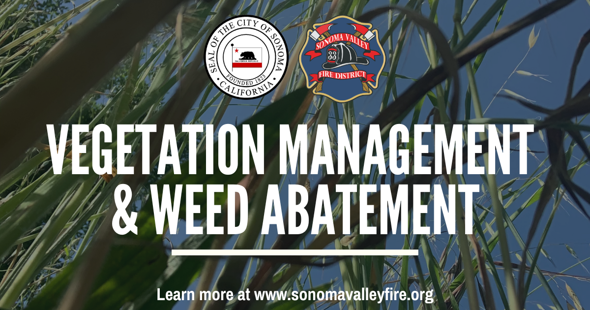
Temperatures are rising, grasses are drying, and fire season is near – it’s time to take measures to create defensible space around your home by managing vegetation. Proper Vegetation Management and Weed Abatement play a critical role in reducing potential fire hazards. The Sonoma Valley Fire District’s (SVFD) Annual Weed Abatement Program is in full swing and is...